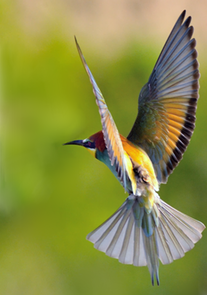
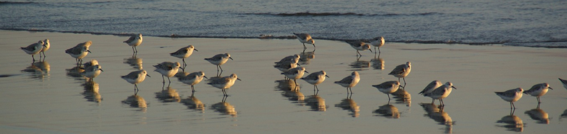
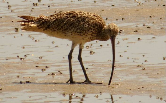
Methods for Conservation and Ecology
I am an ecologist, interested in developing
methodology and theory to inform conservation decisions in a changing world
Did you know that we still have to describe an estimated 15% of plant species to science? Given that 3 in 4 newly described plant species are threatened with extinction, knowing where this undescribed diversity is is important for guiding conservation. In our recent paper in New Phytologist we used a Bayesian approach to estimate the likely numbers of understribed species per botanical country, and the number of of species that are known to science, but have not been geolocated that in country. We then matched our estimates of undescribed diversity (the diversity "darkspots") with known biodiversity hotspots, finding that they overlapped greatly. However, one region fell through the gaps as not yet being a conservation priority - and that is island of New Guinea... You can read more about it:
The Scientific Summary:
0 Comments
Kiran L Dhanjal-Adams, Mathieu Duteil, Baptiste Averly, Vlad Demartsev, Marta B. Manser, Dan Stowell, Ariana Strandburg-Peshkin, Marie A. Roch
Understanding group decision-making in mobile species is complex. The integration of both GPS and acoustic sensors into tags deployed on group members can help us systematically quantify communication between individuals as well as their movement responses - based on who is calling, the context of the call, and how the group reacts. However, the resulting datasets are very large, and the manual identification and classification of calls is both time and labor consuming. Here, we present a supervised machine learning tool focused on detecting call types in field recordings with variable signal to noise ratios. We trained a convolutional neural network to extract features from spectrograms. Bidirectional gated recurrent units learned temporal structure from these features, and a final feed-forward network predicted call type. We also used data augmentation to increase the number of training examples for underrepresented call types. We illustrate the method on entire meerkat groups. The method allows us to view animal communication in a continuous fashion to better understand the social context in which the calls are made to better understand collective decision-making. By Kiran Dhanjal-Adams A bit of maths can help managers minimise the impact of dogs on migratory shorebirds. Walking the dog on the beach is a great way to end a hot summer’s day. Yet little migratory shorebirds are also soaking up the late afternoon sunshine. These little creatures have made it all the way from their breeding grounds in eastern Russia and Alaska to spend the Australian summer feeding on the abundant sea life in the intertidal zone. They patiently wait until low tide to gorge on worms, shells and crabs, before retreating as the tide comes back in. This feeding period is critical to these birds. Many will have flown non-stop all the way from Alaska to Australia, some 11,700 km in 6 days! Consequently, migratory shorebirds are hungry. They will have lost 50–80% of their body mass. However, dogs have a tendency to chase birds. It’s no big deal if it happens only once, but these disturbances can be constant. Repeated disturbances can force birds to leave a good feeding area for less suitable feeding areas. And even if they move, dogs are likely to be wherever they move to. Anything preventing birds from gaining enough weight can mean they will be unable to migrate and breed. Worse, it could mean they migrate and die of starvation before even getting to their breeding grounds. This is a major problem. Many species of migratory shorebird are in rapid decline across Australia. Several species have been recently listed as threatened. In Moreton Bay, for example, some species have declined by 50–80% between 1995 and 2009. The solution to this disturbance problem is simple – we should put our dogs on leashes. Unfortunately, not everyone is aware of the plight of shorebirds or the need to give them peace, and local shorebird managers are encouraged to carry out information campaigns. This is where a little decision science can help. Given they must also manage commercial and recreational fisheries and tourism on top of shorebirds, there is a need to optimise where and when managers carry out information campaigns to avoid wasting precious time and funds. Consider this: if you have ten sites that you could visit up to five times, there would be a total of 60,466,176 possible combinations of site visits. How would you figure out which of these possible combinations delivers the best outcome? A few other numbers and a bit of maths can help. How many birds are at a site? How many disturbances? How much will it cost to manage that site? With this information it is possible to do a cost–benefit analysis to determine which combination of site visits delivers the best outcome within the specified budget. However, the more you visit a site, the more you will start talking to the same people over and over again about shorebirds. There is therefore a trade-off between visiting a site too much and wasting your time talking to the same people, or visiting a site too little. We attempted to explore this trade-off by expressing it as a mathematical formulation. We found that if management was effective (i.e. that almost everyone started putting their dog on a leash after talking to marine park officials), then it was best to manage a lot of sites a few times. However, if management was not very effective (i.e. only a handful of people started putting their dog on a leash), then it was best to find sites with lots of birds being disturbed, and repeatedly visit them. This ensures as many people as possible are persuaded to keep their dogs on a leash near shorebirds. These methods extend well beyond shorebirds. Say, for instance, you are deciding which sites to visit to ensure as many rhinos as possible are protected from poaching, or where to patrol to ensure fish stocks are not depleted. All that is needed is information on target species (average number of rhino or fish), infractions (number of poachers or illegal fishers caught) and the cost of patrolling (number of staff).
Of course, enforcement is not the only tool available in the manager’s toolbox. For shorebirds, for example, better dog-walking facilities would reduce the number of people walking their dogs on the beach. The underlying message is that everything is a balancing act, and successful conservation requires a mix of community involvement, government engagement and implementable management plans. Engaging communities and governments is a long and complex process, but devising cost-effective management plans need not be so with the right tools. Kiran Dhanjal-Adams is an associate of the ARC Centre of Excellence for Environmental Decisions (CEED). This research was done while based at The University of Queensland. This is an article we wrote for the British Ornithological Union's blog which can be accessed here: https://www.bou.org.uk/blogs/range-expansion/ Kiran Dhanjal-Adams & Tamara Emmenegger Swiss Ornithological Institute, Switzerland LINKED PAPER Range wide migration corridors and non‐breeding areas of a northward expanding Afro‐Palaearctic migrant, the European Bee‐eater Merops apiaster. Hahn, S., Alves, J.A., Bedev, K., Costa, J.S., Emmenegger, T., Schulze, M., Tamm, P., Zehtindjiev, P. & Dhanjal‐Adams, K.L. 2019. IBIS, DOI: 10.1111/ibi.12752. VIEW Breeding range expansions The combined effects of climate and land-use changes have recently caused the breeding range of some species to expand. Yet we know very little about what these range expansions might mean for the migratory patterns of the individuals breeding in the newly acquired breeding grounds. Do they continue to overwinter in the same regions as their ancestors, or do they develop their own migratory strategies and non-breeding ranges? One such species that has expanded its breeding range northwards is the European bee-eater Merops apiaster. The abandonment of surface coal mines in regions such as East Germany has opened up habitat for bee-eaters to establish new breeding colonies. In regions such as Saxony Anhalt, the numbers of breeding pairs have even gone from 30 in 2003 to a whopping 1000 in 2018. However, it is unclear where the individuals breeding in these new population came from. Genetic analyses suggest that the species disperses widely, with individuals from these new colonies having mixed ancestry (Carneiro de Melo Moura et al. 2019, Ramos et al. 2013). Thus, we aimed to investigate where and when they migrated: whether individuals followed the behaviour of their source populations with many different migratory routes, or whether they developed their own strategy. Tracking migration We tracked the migration of bee-eaters by deploying geolocators in three distinct colonies: one at the Western edge of the range in Portugal, one at the Eastern edge in Bulgaria, and one in a recently colonized breeding population in Germany. We found that Portuguese and Bulgarian breeding birds migrated to Western and South-eastern Africa respectively, via straight southward routes. The newly established German-breeding colony however migrated along a new and undocumented migratory route, crossing the Mediterranean around the Balearic Islands and stopping over around Nigeria. Most of these birds then continued over to spend the nonbreeding residency period in the Congo basin. New non-breeding ranges suggests adaptation Though the migratory pathways were very different between the German-breeding and Bulgarian-breeding birds, their migratory timing was remarkably similar. This suggests that migratory phenology is triggered by adaptations to site-specific climate and weather conditions. Furthermore, the fact that the tracked birds from Germany all followed a new and distinct migratory route, suggests little influence of source populations in determining migratory pathway. Birds appear to optimise their migratory route to account for the specific requirements of their new ranges. Given the widespread human-driven changes we are currently observing across our landscapes, it is encouraging to note that birds can adapt their migratory strategies to novel environments, under the right conditions. Here is a video summarising the results: Acknowledgements
The Swiss Ornithological Institute developed the geolocator loggers described in the article and the Swiss federal office for the environment (FOEN) contributed financial support for the development of the tags (grant UTF 400.34.11). SOI-GDL3pam loggers were fitted under licence LAU 43.17-22480-58/2015. The Swiss National Science Foundation 31003A_160265 funded S.Hahn. Tracking technology gives new insights into the behaviour of migrating birdsThough much is known about where and when birds travel, a lot less is known about the composition of flocks and how long they stay together. Do birds come together in flocks by chance? Do they actively choose flock members? It’s difficult to understand groups without being able to observe them directly. But advances in technology are changing this. Individual birds can now be fitted with small tracking devices called geolocators which store data from one breeding season to the next. When the bird is recaptured, the data is then downloaded and used to reconstruct the bird’s migratory pathway. Geolocators are useful for tracking the location of individual birds. But they lack the spatial precision to investigate their behaviour. So researchers at the Swiss Ornithological Institute added pressure sensors to geolocators. That’s because pressure is an indicator of altitude, and rapid changes in pressure can tell us when a bird is flying and how high. In a study published in the journal Current Biology, we used these pressure loggers to track the behaviour of groups of migrating bee-eaters. We were able to monitor how these birds moved as flocks, something which was impossible until the development of the new loggers. The technology records how the individual birds are behaving. It allows researchers to see which ones are doing the same thing at the same time – in other words, which ones are making decisions together and coordinating their flight, and therefore belong to a flock. Most surprisingly, we found that birds can spend long periods travelling together with the same individuals, even rejoining each other after separations. What the data showed We fitted 29 loggers on European bee-eaters (Merops apiaster) in 2015 and 2016. The species is very sociable. They breed in large colonies. They also sometimes raise young that are not their own, deciding which birds to help and how much assistance to offer. The species has also been shown to cooperate with other bee-eater species to mob predators and search for food. So we hypothesised that they were also likely to socialise during migration. The data confirmed this theory. We noticed that not only were some of the tracked birds flying and stopping at the same time, but they were also hitting the same altitude simultaneously. This meant the birds were sharing the decision to fly or not; to go up, or down, to make slight shifts or to remain at the same altitude. And this wasn’t happening occasionally over the course of a few hours; the behaviour was noted over months at 30-minute intervals. Such patterns could only occur between birds interacting within the same flock. Data also showed that 49% of the tagged birds migrated 14,000km together from Germany to the Congo Basin and back. The rest split while crossing the Sahara. But 89% came back together again in Sub-Saharan Africa, locating each other despite a month spent travelling 5,000km separately. In Africa, all bird groups would repeatedly separate for one to five days, then come back together again before migrating back to Europe together. The birds that reunited were individuals that had previously spent time together. Even in the breeding grounds, we found that European bee-eaters preferred the company of some individuals over others - and these tended to be the individuals with whom they would migrate. Most surprisingly, none of these birds had previously been caught in the same burrow as chicks or adults (over 95% of the population was monitored by researchers), and were not part of the same family unit. Two pairs of birds also bred together after migrating to Africa in the same flock. Beneficial behaviour This is some of the first evidence we have of birds remaining in long-term flocks with non-family members of mixed age and sex. Waterbirds such as cranes and geese can also migrate in stable multi-family flocks, but later separate into family or juvenile groups once they arrive at their destination. Bee-eaters, however, remain with the same non-family members throughout the year. In a manner of speaking, they form cliques. Most likely, younger birds benefit from the knowledge and guidance of older birds, allowing them to share information on migratory conditions, to change their behaviour accordingly and to adapt to changes in conditions. Furthermore, the species soar-glides during migration. Birds identify thermal updrafts, navigate within these to gain altitude, and leave at the right moment to make it to the next thermal. Young birds, however, often leave thermals at the wrong moment and lose momentum. In fact, it is remarkably difficult for birds with different experience levels to remain together for longer than a few days, unless they compromise and wait for each other. So staying together appears to be a deliberate strategy in bee-eaters, and it is likely that cooperation brings benefits beyond migration. Cooperating could also allow bee-eaters to search for food, defend territories and fend off predators. A deeper understanding Previously, most birds were thought to be guided by their genes during migration: any birds taking “bad” migratory routes would die, while the ones taking “good” routes would survive to pass their genes onto their young. How else could a cuckoo find its way across Europe and Africa when it had never met its biological parents? Our research, however, shows that the picture is a little more complex, and that there is a spectrum of migratory behaviours ranging from genetically-driven (as is the case of the cuckoo) to experience-driven (as is the case of cranes). Knowing that some bird species prefer to migrate with “friends” changes the way we think about the mechanisms that shape migratory behaviour. The ability of birds to survive changing conditions will be clearer when we understand what drives their movement from one environment to another. Disclosure statement Kiran Dhanjal-Adams works for the Swiss Ornithological Institute which developed the multisensor loggers described in the article, and is a member of the Queensland Wader Study Group, Birdlife Australia, the Society for Conservation Biology and the British Ecological Society. This study was co-authored with S. Bauer, T Emmenegger, S Hahn, S Lisovski, F and Liechti.M. Schulz and P. Tamm provided field assistance and long-term monitoring. The Swiss National Science Foundation 31003A_160265 funded two of the study co-authors (S.Hahn and S.Bauer). The Swiss federal office for the environment (FOEN) contributed financial support for the development of the tags (grant UTF 400.34.11). SOI-GDL3pam loggers were fitted under licence LAU 43.17-22480-58/2015. This is an article we wrote with Madeleine Stigner and Richard Fuller for the Conversation Australia There’s no doubt about it, Australians love the beach. And why not? Being outdoors makes us happy, and all beaches are public places in Australia. Head to a beach like Bondi on Christmas Day and you’ll share that space with more than 40,000 people. But we aren’t just jostling with each other for coveted beach space. Scuttling, waddling, hopping or flying away from beachgoers all around Australia are crabs, shorebirds, baby turtles, crocodiles, fairy penguins and even dingoes. Beaches are home to an incredible array of animals, and sharing this busy space with people is critical to their survival. But, if we find it hard to share our beaches with each other, how can we possibly find space for nature on our beaches? Beach birdsHere’s a classic example of how hard it is to share our beaches with nature. Head to a busy beach at dawn, before the crowds arrive, and you will most likely see a number of small birds darting about. You may recognise them from the short movie Piper – they are shorebirds. As the day progresses, swimmers, kite surfers, dog walkers, horse riders, 4x4s and children descend upon the beach en masse, unwittingly disturbing the shorebirds. Unlike seabirds, shorebirds do not spend their life at sea. Instead, they specialise on the beach: foraging for their invertebrate prey, avoiding waves, or resting. However, shorebird numbers in Australia are declining very rapidly. Several species are officially listed as nationally threatened, such as the critically endangered Eastern Curlew. There are few places you can let your dog run for as long and as far as it pleases, which is one of the reasons beaches appeal to dog owners. But this disturbance results in heavy costs to the birds as they expend energy taking flight and cannot return to favourable feeding areas. Repeated disturbance can cause temporary or permanent abandonment of suitable habitat. The fascinating thing about many of these shorebirds is that they are migratory. Beachgoers in Korea, China, Indonesia or New Zealand could observe the same individual bird that we have seen in Australia. Yet these journeys come at a cost. Shorebirds must undertake gruelling flights of up to 16,000 kilometres twice a year to get from their breeding grounds in Siberia and Alaska to their feeding grounds in Australia and New Zealand. In their pursuit of an endless summer, they arrive in Australia severely weakened by their travels. They must almost double their body weight before they can migrate again. And these birds must contend with significant daily disruption on their feeding grounds. A recent study in Queensland found an average of 174 people and 72 dogs were present at any one time on the foreshore of Moreton Bay, along Brisbane’s coastline. And 84% of dogs were off the leash – an off-leash dog was sighted every 700 metres – in potential contravention of regulations on dog control. Managing the menagerieOne conservation approach is to set up nature reserves. This involves trying to keep people out of large areas of the coastal zone to provide a home for nature. Yet this rarely works in practice on beaches, where there are so many overlapping jurisdictions (for example, councils often don’t control the lower areas of the intertidal zone) that protection is rarely joined up. However, our work at the University of Queensland shows we don’t need conservation reserves in which people are kept out. Quite the reverse. We should be much bolder in opening up areas that are specifically designated as dog off-leash zones, in places where demand for recreation is high. In the case of Moreton Bay, 97% of foraging migratory shorebirds could be protected from disturbance simply by designating five areas as off-leash recreation zones. Currently, dogs must be kept under close control throughout the intertidal areas of Moreton Bay. By zoning our beaches carefully, the science tells us that the most intense recreational activities can be located away from critical areas for nature. And there’s no reason why this logic couldn’t be extended to creating peaceful zones for beach users who prefer a quiet day out. By approaching the problem scientifically, we can meet recreational demand as well as protect nature. Proper enforcement of the boundaries between zones is needed. Such enforcement is effective when carried out in the right places at the right time. We believe that keeping people and their dogs off beaches to protect nature is neither desirable nor effective. It sends totally the wrong message – successful conservation is about living alongside nature, not separating ourselves from it. Conservationists and recreationists should be natural allies, both working to safeguard our beautiful coasts. The key is to find ways that people and nature can co-exist on beaches. Making good decisions with limited information This is a post I wrote for Decision Point about my recently accepted paper in Conservation Biology The movie Jaws made great white sharks into world-famous human eaters. Less well-known about great whites is that they can undertake astounding migrations. In 2002, a shark tagged in South Africa was tracked all the way to Western Australia (see Figure 1). Though it lost its tag in Australia, it was re-sighted again in South Africa, proving the species capable of migrating some 20,000 kilometers. Great whites are, however, far from being alone when it comes to astounding feats of migration. Dragonflies have been found to travel similar distances between India and Africa, stopping off in the Maldives on the way. The longest recorded migration of all is that of an Arctic tern, which flew 70,000 km over a year from one pole to the other and back, in search of an eternal summer. A lifestyle on the move is not without risk. Migration is physically demanding, and migratory species are highly reliant on places to stop, rest and feed along the way. Unfortunately, human activities are making it riskier for animals to travel, while also reducing the number of places they can travel to. Fishing, culling, fence-building, deforestation, land-reclamation and plastic pollution are all making it increasingly difficult for many species to migrate. So much so, that migratory species populations are declining at much greater rates than nonmigratory species. This suggests that current conservation strategies are not working as well as we would like them to. We are still at the early stages of understanding migration, and data detailing where, when and how far many species migrate is still sparse. Though a few individuals of some species have been tracked, it remains unclear how these few tracked individuals reflect the migration patterns of an entire species. What should we measure? Because of this poor understanding of where animals migrate, conservation strategies are currently set using the data we have – animal counts. Indeed, it is not unreasonable to assume that sites with lots of migrants are probably more useful to the population than sites with fewer migrants. However, increasingly research is showing that where these sites are relative to each other is equally important. This is because the distance between two sites is likely to impact the number of animals able to travel between the two. Connected sites are therefore more useful to the population than unconnected sites. So, how do we marry abundance measures with connectivity measures to set conservation priorities for migratory species when so few animals have been tracked? To help maximise the value of limited information, we have developed a methodology for using as few as three tracked individuals to calculate the probability of an animal travelling between any two places (Dhanjal-Adams et al, in press). By augmenting these measures with count data, it is then easy to draw up the migratory network of a species. What should we prioritise? We did this for seven migratory shorebird species in the East Asian-Australasian Flyway. We found that conservation strategies that prioritise sites based on connectivity and abundance together, always outperform strategies that only prioritise sites based on abundance (Fig 2). Figure 2: In our study, we drew up a migratory network and removed sites according to different prioritization strategies to see how they influenced population declines. The flow prioritisation strategy (black triangles) includes connectivity data as well as abundance data. The maximum count prioritisation strategy only includes abundance data (squares). The random prioritisation strategy does not include any connectivity data or abundance data, but choses sites at random for conservation. We therefore perform the random prioritisation strategy 1000 times to have a representative spread of possible results (black circles; ±95% quantiles) We compared these three strategies for seven different migratory shorebird species: a) bar-tailed godwit, b) eastern curlew, c) great knot, d) grey-tailed tattler, e) red knot, f) ruddy turnstone and g) sanderling. As you can see, the flow prioritization strategy always outperforms the count prioritization strategy and random prioritisation strategy. Interestingly, sites with a smaller number of birds can be given a higher conservation priority than sites with lots of birds. This is because groupings of small sites can act as a unit, which together, support a higher proportion of the population than an isolated site with a higher bird count. These groupings of small sites are therefore prioritized over the site with slightly more birds. However, these tradeoffs are complex and difficult to predict, making it important to draw up a migratory network during the planning process. By using very simple metrics, we show that it is possible, despite a lack of tracking data, to come up with estimates of where migratory species might travel, which in turn can be used to inform conservation planning. Importantly, given migratory species are declining despite the current protection, methods like the one we have developed can be used to determine the value of adding additional habitat to the current network of protected areas. Mapping the distribution and protection of intertidal habitats in Australia Somewhere between land and sea lie intertidal habitats such as sandflats, mudflats and rocky reefs. These in-between places provide a wide range of valuable services including fisheries, recreation, buffers to sea-level rise and storm protection. Yet the distribution of these habitats, and therefore how well they are protected in reserves, remain unknown at a national level, below a 10km resolution. Of course, mapping the distribution of a habitat which is repeatedly inundated can be remarkably complex, even using remote sensing. That’s a big part of the reason we know so little about the distribution of these habitats. With Landsat imagery for example, images (which are taken only every 16 days) must coincide with the highest and lowest astronomical tides on a day without cloud, to create a map. Finding suitable images at a national level is therefore difficult, but not impossible. In our study, we were able to combine 15 years of images to produce the first map of intertidal habitats for Australia at a 30m resolution (the shapefile can be found at https://doi.pangaea.de/10.1594/PANGAEA.845726) (Dhanjal-Adams et al, 2016). The method we used to map the extent and distribution of intertidal habitats in Australia was based on a continental-scale mapping project conducted across Asia by Nick Murray and colleagues (Murray et al, 2012; and see Decision Point #81). Of the 9,856 km2 of mapped habitat, we discovered large intertidal areas, particularly in Western Australia, Queensland and South Australia, along embayed coastlines and river mouths. Furthermore, we discovered that 39% of mapped intertidal habitats fell under the jurisdiction of one protected area designation or another (fig. 2). Levels of protection varied considerably between states ranging from 80% in Victoria to 6% in the Northern Territory. We were also surprised to discover that some states mainly protected intertidal habitats as part of marine protected areas (eg, Queensland), and others as part of terrestrial protected areas (eg, Victoria). In some cases, 3% intertidal habitats were protected both by marine and a terrestrial protected areas (10% in South Australia). Given the importance of intertidal habitats, there is a strong need to better understand how these designations can impact management of intertidal species. Intuitively, we might expect such designations to lead to better protection with both marine and terrestrial protected area managers collaborating. However, there is also the potential for confusion, with neither organisation sure who should take the burden of responsibility. The protection of intertidal habitats is undeniably blurred, but with great potential for improvement. By providing the most accurate map of intertidal habitats to date, our research provides the data needed to better align protected area boundaries with intertidal habitats. In so doing we can improve the protection afforded to the many amazing species these habitats support. This is a post I wrote for the Journal of Applied Ecology on my recent paper ‘Optimizing disturbance management for wildlife protection: the enforcement allocation problem’ Determining where and when to carry out enforcement patrols can be a complex issue. Imagine for instance that you have 10 sites that you want to visit between 0 and 5 times…There would be a grand total of 60,466,176 possible combinations of site visits. So how do you figure out which one of these 60,466,176 possible combinations works best for you? Then of course there is the issue of how effective the enforcement actually is. Maybe people are stubborn and don’t want to change their behaviour to follow regulations. Or maybe they are very fearful, and go somewhere else to avoid patrols. If people are fearful and avoid patrols, it is both expensive and useless to keep patrolling the same site when no one is there. There is therefore a sweet spot, in other words an optimal number of visits, which ensures a site is not being visited so little that enforcement has no effect, or visited so much that money is wasted. Our recent paper in the Journal of Applied Ecology examines these trade-offs and investigates where managers should patrol, and how often. The problem can be broken into two parts. Firstly, what is the benefit of enforcing regulations? And secondly, what is the cost of enforcing regulations? Because we are birders and we live in Australia, we use the case study of declining migratory shorebirds and dogs on beaches to illustrate our approach. Indeed, the shorebirds that we see here migrate 11,000 kilometres, all the way from Alaska and Russia, to spend the summer feeding on worms, shells and crabs in the intertidal zone. Dogs, though cute, have a tendency to chase birds. One dog can cause hundreds of birds to take flight, and if this occurs regularly, the birds cannot feed and gain the weight necessary to complete their long-distance migrations. Enforcement is very simple. It involves increasing the number of dogs on leashes. Like I said before, there are two parts to the problem: the benefit of enforcement, and the cost of enforcement. Benefit here can be thought of as the number of birds no longer being disturbed. Cost is simply that of travelling to a given shorebird site and time spent enforcing. Because we are unsure, without extensive fieldwork, how effective enforcement is (i.e. how many people actually continue putting their dog on a leash after enforcement), we tested two scenarios. One where people are stubborn, and don’t want to put their dog on a leash, and another where people immediately start putting their dog on a leash. The results are surprisingly similar between the two scenarios, many of the same sites appear important in both. What varies is the number of times these sites are visited.
Quite intuitively, if people are reluctant to follow regulations, a site must be visited more often, while if people are willing to follow regulations, money should be invested visiting lots of sites a small number of times. This shows that the methods we develop make sense, but to figure out the exact number of visits to a site, it remains essential to do the maths. No pain, no gain! |
Kiran L. Dhanjal-AdamsI love shorebirds, R and karate. All views expressed are my own. Archives
November 2024
Categories |